Topography of terrain of any complexity
Inventory of land plots and infrastructure elements
Executive survey of underground utilities (gas pipelines, water pipelines, sewerage systems)
Coordination of underground networks
Street passport
Topographic survey of the area on a scale of 1: 500-1: 2000
Monitoring of railway pavement and tracks
Topographic survey of roads
Topographic Survey
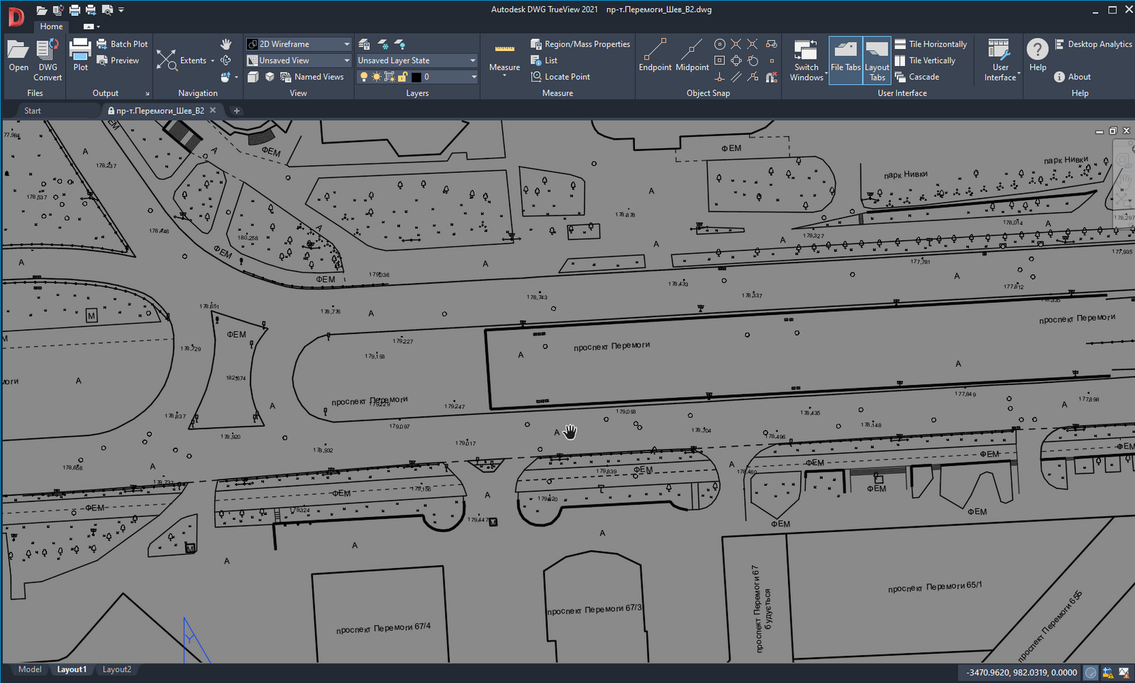
Topographic survey is a complex task involving the creation of terrain plans, topographic maps, street passports, and more. A topographic plan is a flat drawing, most often in DWG format. It includes all infrastructure elements, green spaces, individual trees, buildings and structures, road or street network objects, water bodies, utilities, terrain, and other details using special designations. Topographic surveys can be conducted at various scales: 1:500, 1:1000, 1:2000, 1:5000.
Based on the topographic survey, a digital terrain model can be constructed.
In our work, we use classic geodetic equipment and a Gexcel Heron MS2 mobile scanner. The mobile scanner allows us to obtain a topographic plan several times faster, with greater detail, ensuring no infrastructure element or elevation change is missed.
Stages of work
First stage
preparatory, when the specialist receives the necessary information about the object with which he has to work. At the same stage, the selection of positions for installing the scanner takes place.
Second phase
is the direct collection of information using appropriate equipment
Third stage
processing of the obtained data, as well as the creation and provision of the work result in a form convenient for the customer with a full analysis of dimensions.
Get Service
Home Menu
Service Menu
OUR OFFICE
st. Bratislavskaya 14-B, office 7
Tel: +380673831972
Tel: +380504003900
Email: 3dscan.ua@ukr.net